Habitat....
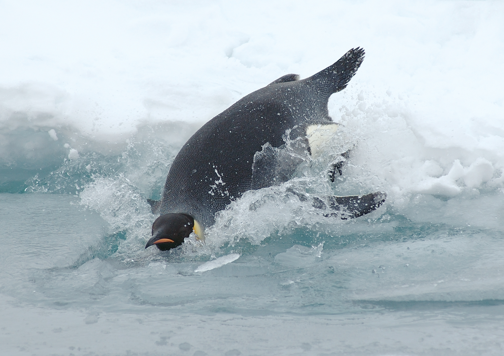
Gathered in huge groups sort of like colonies, emperor penguins live off the coast of Antarctica. Unlike other penguins, the emperor penguin do not migrate to warmer climates during the winter. This would be would of the toughest penguins because they survive in harsh weather conditions and breed during that time as well. Emperor penguins usually use the coastal ice cliffs for shelter. They can generally spend most of their life without ever having to come on the land.


Predation & Prey...


 Honestly I think the breeding system is cute. The emperor penguins breed during the winter months so that by the time it gets warmer the chicks will be mature to leave mom and dad. Thats smart because the weather conditions are much better. The emperor penguin reproduces internally, and early winter is when they start mating. Around May the female penguin lays one egg and passes it onto the father immediately after and he will be in charge of the egg for 3-4 months with out food. But of course he fills up his belly for the long days ahead. All of the males huddle together to keep warm, while the females store up food for their young. When it is time for the chick to be born, at the beginning of September the female returns from the ocean to find her baby. The chicks can recognize their parents from their call. The parents take turns going back and forth getting food for the newborn until they old enough to get on their own and venture out.
 The emperor penguins has 4 layers of skin to protect them from such cold Antarctic weather. Even though they wobble while walking their feet, to speed up the process they flop on their stomachs and slide using their wings to push themselves along the ice. As mentioned the males huddled together, each taking turns so each of them in a group can feel the warmth in the interior to help them survive.
 The emperor penguin is not listed as endangered but there is a concern because scientist say that by the way the climate keeps changing, human distrubance and global warming can decling breeding. Melting is a big factor for breeding locations as well.


Emperor penguins are very good swimmers and they are very strong making them good predators. They are alos great divers, diving as deep as 1750 ft holding their breath for about 18 minutes. Emperor penguins usually feed on fish, krill, and squid. And larger marine mammals prey on them and sharks as well during the spring.
Reproduction...

 Honestly I think the breeding system is cute. The emperor penguins breed during the winter months so that by the time it gets warmer the chicks will be mature to leave mom and dad. Thats smart because the weather conditions are much better. The emperor penguin reproduces internally, and early winter is when they start mating. Around May the female penguin lays one egg and passes it onto the father immediately after and he will be in charge of the egg for 3-4 months with out food. But of course he fills up his belly for the long days ahead. All of the males huddle together to keep warm, while the females store up food for their young. When it is time for the chick to be born, at the beginning of September the female returns from the ocean to find her baby. The chicks can recognize their parents from their call. The parents take turns going back and forth getting food for the newborn until they old enough to get on their own and venture out.
Adaptations...
 The emperor penguins has 4 layers of skin to protect them from such cold Antarctic weather. Even though they wobble while walking their feet, to speed up the process they flop on their stomachs and slide using their wings to push themselves along the ice. As mentioned the males huddled together, each taking turns so each of them in a group can feel the warmth in the interior to help them survive.
Conservation....
 The emperor penguin is not listed as endangered but there is a concern because scientist say that by the way the climate keeps changing, human distrubance and global warming can decling breeding. Melting is a big factor for breeding locations as well.
Classification
Aptenodytes forsteri

Interesting Facts
 The emperor penguin is the tallest and heaviest of all known penguins. They reach up to a weigh anywhere from 22 to 45kg.
Even though it considered a bird and has wings, highest feather density of any bird species, it cannot fly.
 The emperor penguins can start mating when they are 4 years of age.
Emperor penguins have a life span of about 20 years.